The Wolston and Centenary Creek Catchments consist of the Wolston Creek and the Centenary Catchments across the City Council areas of Brisbane, Ipswich and Logan.
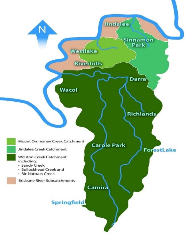
The Wolston Creek Catchment has three main tributaries merging into Wolston Creek Sandy, Bullockhead and Ric Nattrass Creeks. This catchment forms part of an important wildlife corridor from the Brisbane River through, Pooh Corner Bushland Reserve, Wacol Bushlands, continuing into the Greenbank Military Training Area 11 kilometres to the south.
The map shows the area travelled by these creeks on their way to entering Wolston Creek. Sandy Creek runs through the suburbs of Camira and Carol Park on its way through Pooh Corner Bushland Reserve to Sumner Park. Bullockhead Creek runs through the suburbs of Forest Lake and Richlands, through Wacol Bushland to Sumner. Ric Nattrass Creek runs from Richlands through Wacol Bushland to merge into Bullockhead Creek.
Vegetation in parts of this catchment area has been classified as Endangered Regional Ecosystems or Of Concern. These classifications mean that the plant species and the soil types are either rare or significant.
The Centenary Creek Catchments consist of two main creeks, Mount Ommaney and Jindalee that flow into the Brisbane River to the north of Wolston Creek. This area is highly urbanised, mainly residential but with some natural bushland reserves.
WaCC follows the principles of bush regeneration, considering the existing ecosystem strengths and where possible assisting natural regeneration. For more information on the principles of ecological restoration and rehabilitation, repairing degraded bushland and riparian areas, and choosing the right method for your site, visit the Australian Association of Bush Regenerators website.
Maintaining several Bushcare sites is attributed to our team of enthusiastic and knowledgeable volunteers who persistently check plant survival rates while removing weeds.